The Interactive Air Quality Map: Vlog 1 - The Story So Far
Follow article
 Dave from DesignSpark
How do you feel about this article? Help us to provide better content for you.
Dave from DesignSpark
Thank you! Your feedback has been received.
Dave from DesignSpark
There was a problem submitting your feedback, please try again later.
Dave from DesignSpark
What do you think of this article?
The Interactive Air Quality map is a tangible representation of an area that visually depicts the air quality of its various locations. By a simple touch on an area of interest, the map enables users to access the air quality information specific to that location. Its purpose is to promote air quality awareness among individuals in a manner that is both accessible and comprehensible.
This project was created In light of the concerning air pollution issue in Lagos state and the unexpected lack of awareness surrounding it.
Lagos state is one of the fastest growing megacities in the world, ranked 8th in the same context as Delhi in India and Shanghai in China, this growth should ordinarily be seen as progress, but as it stands, infrastructure in Lagos is not growing at a corresponding rate to support the growth, in a lot of cases, it's actually depreciating due to neglect. Despite the drastic growth in population, and an obvious need for alternate and better transportation systems, second-hand cars and buses remain the primary means of transportation in Lagos, despite the increase in industrial establishments, there’s no system in place to regulate industrial emissions, and the Lagos power grid is severely underpowered and currently incapable of meeting the states power demands, which has only strengthened the state's reliance on gas-powered generators. All of these problems have inevitably contributed to the air pollution problem in Lagos, in 2018 the world bank attributed a staggering 11,200 premature deaths to poor air quality.
When I started this project, the first thing I tried to do was quantify and understand the problem through research, but it dawned on me very quickly that Lagos state does not currently have a reliable air quality monitoring system in place, this realization defined the first goal of the Interactive Air Quality Map project. I am not an economist, and I will not pretend to understand the governance and politics that go into state planning, what I am is a pretty good engineer, and seen as air pollution and the corresponding solutions are always data-driven, I figured the first thing to do in addressing air pollution in Lagos is to provide a scalable open source network of ground-level air quality monitors that will hopefully help the government in devising plans to reduce air pollution around Lagos state, particularly in the residential areas.
The second and most important part of this project is directed toward keeping the public aware of the outdoor air quality that they are exposed to, to help people understand that they can and should try to protect themselves. It's also meant to demonstrate the kinds of creative technological solutions that a working air quality sensing network can inspire.
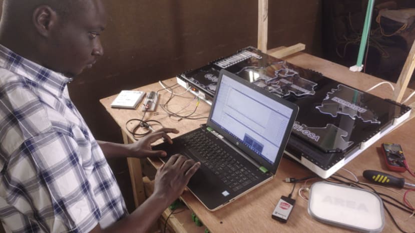
Throughout the majority of the previous year, my focus was on verifying the technical components involved in constructing the IAQM. The process began with exploring methods to develop capacitive touch edge-lit map cells, followed by the creation of a mobile logger utilizing the EDSK. Additionally, I conducted miscellaneous experiments with magnetic pixels. These endeavours culminated in the successful completion of the prototype for the interactive air quality map.
Now, having confirmed the functionality and integration of the IAQM system, the next phase is to begin introducing the map to Lagos state, starting with setting up a sensor network, allowing us to start delivering potentially life-saving air quality information to people.
Follow Ahmed's weekly progress in developing the Interactive Air Quality Map 2.0 across Lagos.
Comments